Fundy Footpath | Access Trail | Rapidy Brook Trail
Hi there, friends! It’s me—Rumor, your favorite muddy-pawed, trail-sniffing adventure pup! Today was a little different. My big sister Keisha stayed home because she’s taking things a bit slower these days. So I flew solo (okay, with my two humans tagging along) on a brand new trail: Rapidy Brook Trail, an access trail to the legendary Fundy Footpath!
Mom had a hard time finding info about this one, so we went full explorer mode—packed up the jeep, drove down some winding gravel roads, and set off into the sprucey woods to see what we could sniff out.
Trail Overview
Location: Little Salmon River West (Near the Fundy Footpath, between The Fundy Parkway and Fundy National Park)
Distance: 0.89 km one way
Difficulty: Moderate
Dog-Friendly: Yes! No signs about leashing—woohoo!
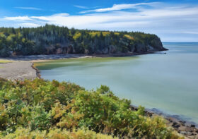
Scenic Views: None
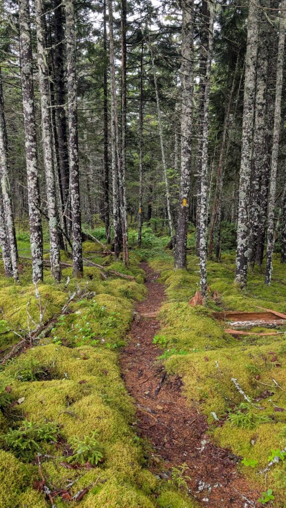
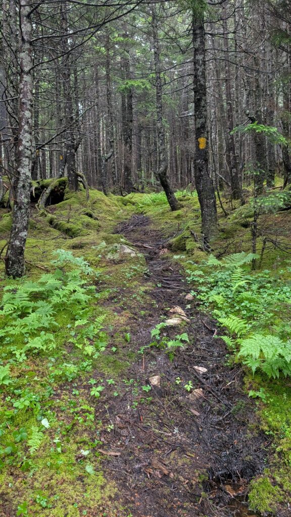
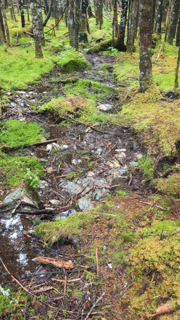
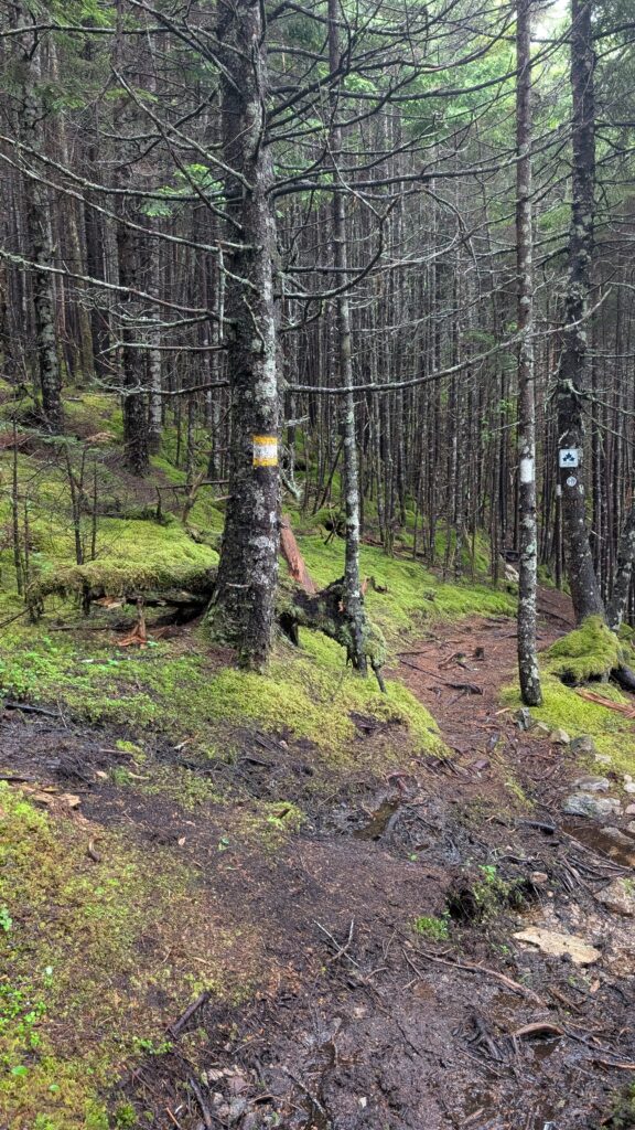
Trail Condition: Rugged but clearly marked with yellow blazes
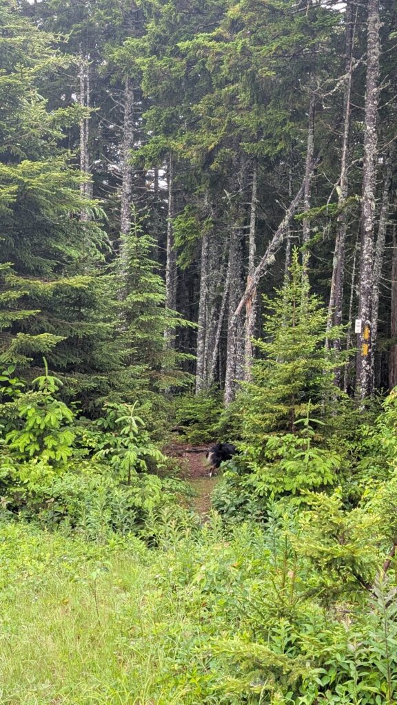
We found the trailhead thanks to a teeny tiny white sign on a tree that simply says “Footpath” with an arrow pointing down into the woods. Subtle, but if your nose is as good as mine, you won’t miss it.
The trail is tucked into the forest and lined with tall spruce trees and soft moss. It starts off with some nice flat sections—great for zoomies—but don’t get too comfy! Most of the trail is rooty, muddy, and full of squishy surprises. And friends… oh, the mud. Glorious, glorious mud! I may have lost a few white hairs to the muck, but it was worth it.
Now, I’ll admit—I get a little wild on hikes. I bound, I leap, I charge ahead without a care. Mom spent most of the hike gasping and muttering something about “broken legs” and “insurance premiums.” Pfft.
The trail mostly heads downhill toward the Fundy Footpath. It’s not super steep, and my humans managed the return climb just fine—though I did race back and forth between them the whole way, checking in, encouraging them, and, well… running just for the sheer joy of it!
At the junction with the Footpath, we met a pair of through-hikers. Naturally, I barked at them. A girl’s gotta announce important trail visitors! They seemed nice, though. Probably didn’t expect a fluffball greeting this deep in the woods.
It’s a short hike, but one full of texture, smells, and adventure. Just keep your paws nimble and your eyes on the yellow blazes! This is a great access trail to the Fundy Footpath.
Rumor’s Rating

Rumor has it, this trail is short, sweet, and perfect for a splash of solo mud magic.
Rapidy Brook Trail Pics
Directions to the Trailhead
This one is not so straight forward!
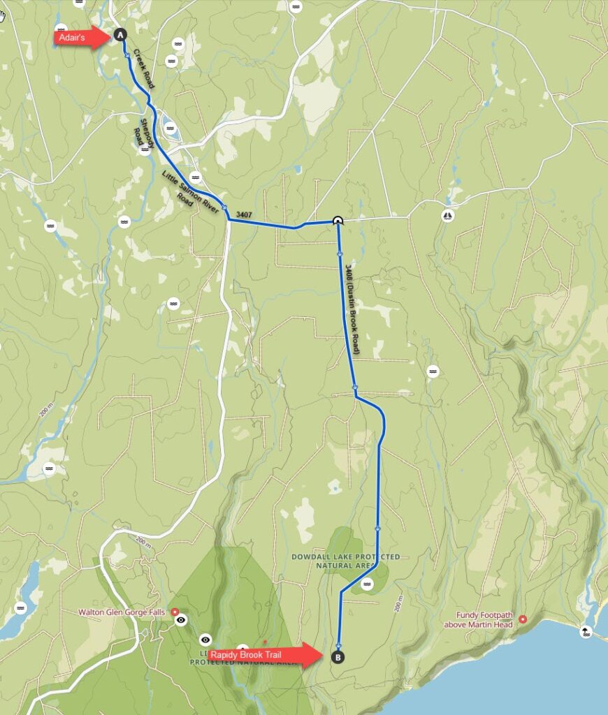
From Sussex, navigate to Adair’s Wilderness Lodge.
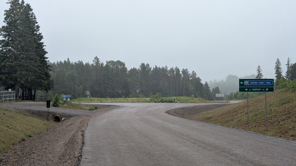
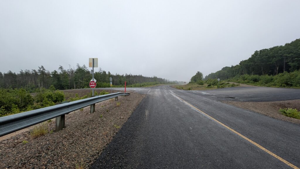
Continue past Adair’s on Creek Road. After 1.5km, the road splits as seen in the photo.
Stay left at this split, following the sign that says ‘Sentier Fundy Trail’.
Drive an additional 3km.
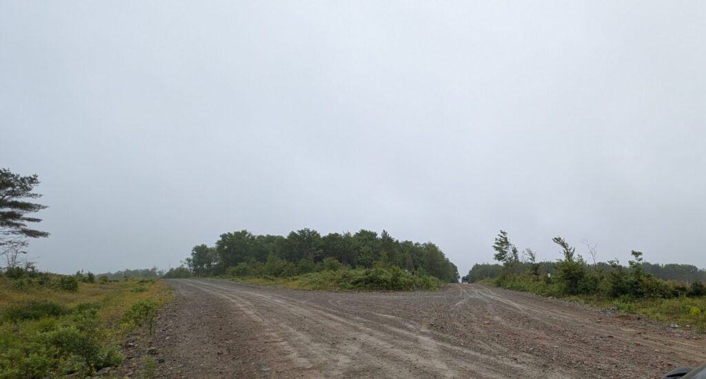
You will see the intersection shown in the photo. There is a sign on the left side of the roadway marked 3407.
Turn left here at this intersection. Once you turn onto this road, it quickly turns to a dirt/gravel road.
Continue on 3407 for 1.6 km.
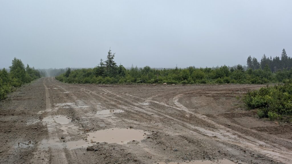
At this point, you will see the road split again with a road that runs off to the right as shown in the photo.
Turn right here—you’ll see two signs as you head down this road. On the right side of this road, a faded sign that says ‘FFP Access’ and on the left side of this road, a sign that says Martin Head.
Follow this road for 0.6 km and you will see a road that turns off to the right. There is a sign just ahead of this that identifies the road on the right as 3408.
Take the right to go down 3408. This is Dustin Brook Road.
Drive 3.5 km.
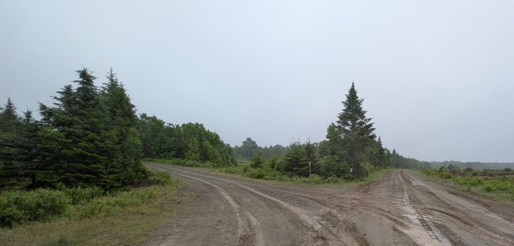
The road splits again as shown in the photo.
There is a white sign in the middle between the two roads—it says Rapidy Brook Trail Access and points left (though it’s a bit faded). Take this road to the left.
Continue on this road for 5.7 km. The road ends at a rocky mound. Park here.
Walk over the mound, and you’ll see a small white sign on a tree that says ‘Foot Path’. That’s your trailhead!
Note: Google maps can navigate here. Just take the coordinates from the map below and put them in google maps!
Here is the GPX map we generated on route to the trail head (from Adair’s Wilderness Lodge)…
That’s it for today, folks! See you on the next trail—muddy paws and wagging tails until then.
Love,
Rumor 🐾